Gravel
Franks Lake Flyer - 71km
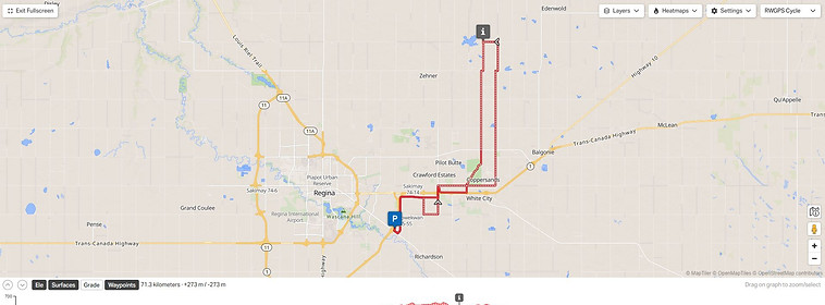
Regina, SK
Description:
This is a mixed surface ride that is best experienced on a gravel bike. A mountain bike could also be used.
Parking is available at the start location. The route starts on the South Service road of the Regina Bypass, this route does not have any services available directly on the route, though they are near.
This route will have you ride some dirt, sand, pavement, large grid roads, and even some doubletrack. Enjoy the scenery as you head north to Frankslake. Take a moment to stop in Franslake to see some of the old abandoned buildings and take photos.
The route takes you south from here to White Butte Nature Trails where you can hop onto the connector trail and ride some double track before exiting back onto some pavement to finish off the route back where you started.
Distance: 71km
Elevation: 273m
Road Surface: Gravel roads, could be some sandy sections.
Region: South East Saskatchewan
Municipality: Regina
Amenities: None directly on the route. Parking available at the start location.
Author: Paul Cutting
Route: https://ridewithgps.com/routes/54224646
Video: N/A


Neither this website nor any individual contributors of route information accept responsibility or liability for injuries, damages, losses, mishaps, or unpleasant surprises of any kind that may occur while riding a route shared here. Disclaimer